We are now southeast of Tucson at Kartchner Caverns State Park, in site 54..
 The park has 60+ sites and is mostly empty maybe 7 people here. When we got here the camp host moved us to a better site than the one I picked online. He said they were mostly empty until Thanksgiving and then the campground is full until March.
Author: harrylange
Titan II Missile Museum, Tucson, AZ – Sunday November 2, 2014
Visited the last Titan II Missile installation which is 20 miles south of Tucson. This is the last installation of 54 Titan II ICBM missiles of the Cold War. These missiles could travel 6000 miles and deliver a 9 megaton war head with a launch time of 58 seconds. The war head would directly have an effect on a 17 mile radius from the landing point.

 We got a one hour tour down into the site including the control room and missile launch silo.
 This is one of the seven blast doors each weighing 6000 pounds which can be closed by a single hand lightly pulling on the door handle.
 This is the main control panel where the watch officer sat.
 Here is one of the main passages within the complex.
 Here is the missile from an access point that was cut into the silo so we could see what the missile looked like inside it’s silo.
 Picture from the silo.
 Here we were looking done into the silo.
 The launch missile site.


This is a picture of Titan II missile launched from an above ground launch site.
It was a very interest tour and we are glad we went.
PIMA Air & Space Musuem, Tucson, AZ – Friday October 31, 2014
We spent the whole day at this airplane museum Pima Air & Space Museum. We walked in at 10:30 and left when they closed at 5:00.

 The museum is just east of Tucson and is a history of aviation.
 Starting with the Wright Brothers and continues into space.


It is about three quarters military aircraft.
Here are the military planes I was most involved with.

F-4 was the attack plane which flew out of Danang when I was there.
 They have several iconic B-52’s and they are massive planes.
 This is one of the planes we flew on out of Danang, C-121.


 I know a lot of these pictures of the same plane, however this may be the last time I get to see one of these.
 We also flew on a P-3 nose number 31 and 32.

 Ok, last picture of a P-3, I actually did pretty good and only took 200 pictures during the day. We took 3 one hour tours: 1 & 2 were walking tours through hangers and the third was a tram tour outside where many planes were parked.
 One of the buildings was build by the 390th Bombardment Groupwho flew B-17’s.

 This painting on the wall shows what it was like inside the plane.


 The gunner’s position under the plane.
 The actual position.
 This is 1943 Ford jeep, I had a 1942 one of these during high school. Note the gas tank under the driver’s seat.

I took this picture of the flight deck of a glider to show how minimal they were, thought it is interesting.
It was an interesting day. When we get home and have more bandwidth I plan to send some time on these two websites.
Mission San Xavier, Tucson, AZ – Thursday October 30, 2014
We visited the oldest Spanish style building in Arizona the CatholicMission San Xavier, started 1783 and opened as church in 1797.


There was a bunch of scaffolding in the church as they are always working on restoring the paintings and statues. When we got home I found I not taken any overall pictures of the inside of the church ( ripped these from the church website ).


 These are some of the original beams that were then covered with saguaro cactus internal wood ribs and then adobe.
Saguaro National Park, Tucson – Tuesday October 28, 2014
We spent two hours at Saguaro National Park East side driving the park and taking pictures of cactus.

 Tucson got cold a few years ago and killed many Saguaro’s


 Here is some more pictures of cactus.


 Hank and I thought it was a warm day but we have a great time.
Catalina State Park – Tucson, AZ – Monday October 27, 2014
We moved into Arizona where weather is going to stay within the mid 80’s for the next week.

Campsite picture site #45.
We were here in September 2004 when Jean started the conversation about if we were going to continue to travel in an RV we should think about what we were going to do long term. We decided to start looking at a larger unit. In November 2004 we found what we thought was close to the perfect Class A. We were not too excited about the interior green color however over a short period of time we began to love it. The green is easy to keep clean and we have been able to match it for extra pillows and throws.
At this point we love the way our RV is configured and don’t want to look for a newer unit. The last unit we sold with 51,000 miles and to date we have 72,000 miles and many more to go.
Pancho Villa State Park – Saturday October 25, 2014
We drove to Pancho Villa State Park this morning.
 This military action just before World War I was the first time the U.S. Army used a mechanized military force. They had four wheel drive vehicles and airplanes.


 Look the way the landing gear was attached to the airplane.


Here is a closer look.
The state park is 30 south of here and 2 miles north of the border. It was a nice drive.
Rock Hound State Park – Thursday October 23, 2014
 When we got up this morning I found this small brown bear in our campsite.
 Hank gets groomed every 6 weeks, it’s been 14 weeks and we still have another 4 to 5 weeks to go.
 This is his normal mid grooming look. We where at Henskin Lakes with Brian in July.
 This is shortly after a grooming, notice the size of his paws. I like his new look, Jean is looking forward to a grooming.
Rock Hound State Park – Tuesday October 21, 2014
We stayed home and a did lot of nothing.
Hank and I took a short hike around the park.

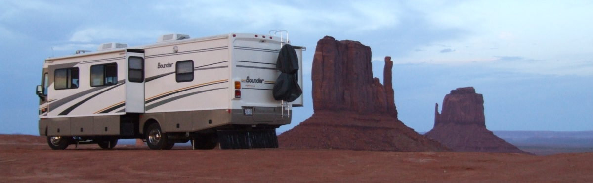
 We have nice view over the valley, our motorhome is in the center.
 This is flower about the size of a quarter.

This was lunch.
It was a great day.
Gila Cliff Dwelling National Monument – Monday October 20, 2014
We went to Gila Cliff Dwelling National Monument north of Deming. It was a long drive from Deming, looking at the map it is not to far, however half of road was a paved logging road. It was actually fun to drive. Poor Hank had to stay at home, he had an eight hour wait.


 These dwellings are half way up a 400 foot rock face.
 There were three volunteers at the dwellings telling the story of the people who lived here.

This is a view in the largest room.
It is a neat place out in the middle of no where.