We leave in the morning heading home. I may not see a blue sky for awhile so I decided to put a picture of where I’ll be able to find it when needed.
 Posted from WordPress for Android
My Life and Travels
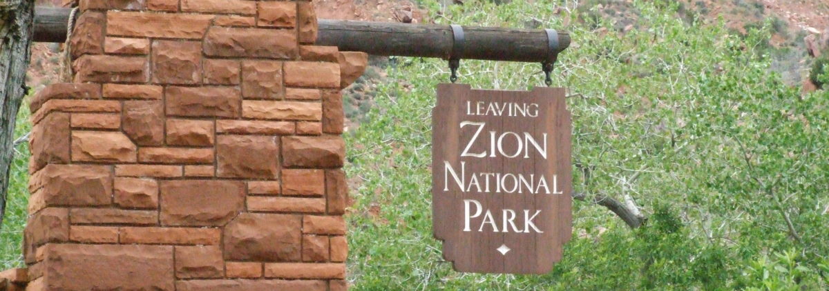
We leave in the morning heading home. I may not see a blue sky for awhile so I decided to put a picture of where I’ll be able to find it when needed.
Posted from WordPress for Android
Last September when we were here Tanya and I took a day hike up the Virgin River. This area is known as the Narrows of the Virgin River. This hike was though the Zion Canyon Field Institute zionpark.org. While we were on the hike Bill Boswell took a group picture and submitted it to the institute to use as they saw fit.
The picture was used for the 2011 counter card to promote the institute’s annual hike schedule.
Here is Bill’s picture, his website is boswell.ca.
 It’s nice southwest afternoon 91.6, 13% humidity.
oday was the warmest day so far, 85+.
Hank and I went for a morning walk and man it was cold. Cold down canyon wind only had us out for an hour. Jean and I took the shuttle bus up the canyon for first time this trip.
Here are some of the pictures I’ve taken this year.
Google has changed a couple of the setting since the last time I published an album, please let me know if you can not view this album, it has 58 pictures.
It’s Wednesday afternoon and I’m doing a little catch up.
We left Richards on Monday morning at 6:00 a.m. heading east on I-80. We took I-80 rather than Hwy 50 because of the weather. Saturday evening we had enough snow at Richards to turn the grass white and with several of the passes on Hwy 50 over 7000 feet I decided we’d take the longer but lower and more traveled I-80. The drive was uneventful until 6:00 p.m. the motorhome got a rock chip in the driver’s side wind shield.
Tuesday morning we found a rock chip repair place 3 miles from the Walmart we had spent Monday night. After the rock chip repair we headed south again.
We stopped to pee hank at a combination state rest stop and Flying J gas station in Beaver, Utah. After I pee’d hank we were just starting to pull out when the guy who had been emptying trash cans waved at us. I got out to see what he was looking at, when I started to move he saw a small flat spot on the outside tread of one tire. The short story is about 90 minutes later we left the Cooper tire dealership with 6 new tires.
Had a great birthday, Jean got me a book, “1001 songs you must hear before you die.” She’s already planning on me dieing, or at least setting some goals as to when.
It is now Thursday afternoon. I went for a 3 mile ranger lead hike up to the Watchman Lookout point this morning. Left at 8:45 and got back at 12:45, took 225 pictures.
It is nice day 79 and sunny.
Here are some pictures:
 Hank is in vacation mode.

Here is some of the damage from last winter’s flood. The river was to the left of this tree last summer with a nice trail along the river. In September when Tanya and I hiked the Narrows the river flow was at 42 cfs (cubic feet per second). The Narrows is open for hiking when the flow is at 100 cfs or below. Today it’s at 623 cfs and at the height of the flood it reached 8000 cfs ( eight thousand is not a typo).
Here are a couple of flower pictures I took today.


 We are having a great trip.
Full sun shine today.
 Posted from WordPress for Android
At Fort Flagler for the weekend, it will start raining any minute from now.
 Posted from WordPress for Android
So far a nice weekend at Flagler.
 Posted from WordPress for Android
First trip of the year, Fort Flagler. Little wind and rain, Northwest camping got to love it.
Posted from WordPress for Android
We are out and about this weekend. Nice rainy weekend at Penrose state park. Original plan was. Belfair state park, however the park was closed. The sign on the gate said the water was off and they didn’t know when the park would open.
 Posted from WordPress for Android
Sunny warm day no clouds and only light breeze. It’s 4:00 we are at a large rest stop on I-84 just east of Mountain Home. Came 399 miles and ahead of schedule, started the morning 3 hours farther north then usual.
Will rest here a while before moving on. Get gas in Boise and spend the night at a rest stop just inside Oregon, that rest stop does not have internet coverage. Be home tomorrow : 🙂 & 😦
Update
7:00 pacific stopped for the night, 534 miles today and 532 from here home.
Posted from WordPress for Android